Remote inspection of an 8000 square meter area in just two hours with 3D laser scanning
U’s Factory Co., Ltd., a Japanese Building Information Modelling (BIM) management company provides one-stop consultation services, including surveying, 3D measuring, and 3D modelling for general construction companies and large design offices.
They use a combination of Leica Geosystems digital solutions for dramatic time savings in their onsite surveys:
- Leica BLK360, a lightweight, fast, compact imaging laser scanner to scan confined spaces safely and reduce data processing time.
- Leica RTC360, a high-speed, agile, precise 3D laser scanner with a seamless automated transfer of field to office data.
- Leica GS18 T GNSS RTK rover, unmatched efficiency and increased safety for accurate point measurement.
Integrated surveying and laser scanning technology for virtual site visits in challenging conditions
Phu My Port, a general cargo port in Southern Vietnam, offers fast and reliable port services to customers all year round. When challenged with procuring complete datasets of the port, the project team used laser scanning to collect the data and create a 3D BIM model of the entire port for ongoing inspection and maintenance. It included the main berth, 72-metre-long access bridge, yard, warehouses and facilities.
The unpredictable tropical weather added further complexity in scanning the 30-hectare area with narrow spaces. Based on previous experience carrying out similar surveys in the region, the team knew it was crucial to combine the data accurately and transfer it from field to office without any risk of delays.
The surveyors chose an integrated reality capture solution from Leica Geosystems allowing for fast precise real-time data transfer:
- Leica ScanStation P50, a highly durable scanning solution with 1-kilometre range and 1-millimetre accuracy; it was used to capture data across large surface areas from a safe position on site.
- Leica RTC360, a flexible, portable 3D reality capture solution that measures up to 2 million points per second was vital in scanning isolated and inaccessible areas accurately and quickly.
- Leica Infinity and Leica Cyclone served as the digital bridge between field and office, the software processed and exported field data in exactly one second, enabling the teams to collaborate in real-
The BIM model for the entire port incorporated highly detailed, accurate data enabling remote quality checks and maintenance. As a result, the port owners continue to operate the port effectively during crises with reduced manpower costs and lower operational risks.
Three ground-breaking technology solutions from Leica Geosystems that are currently facilitating BIM adoption in the construction industry are:
- Leica Nova MS60 MultiStation, total station functionality combined with 3D laser scanning delivers state-of-the-art imaging and augmented reality to extract intelligent data equipping surveyors to work solo safely, efficiently, and fast while surveying unsafe terrains, steep angles, and awkward positions.
- Leica GS18 I GNSS RTK Rover, a cutting-edge instrument with the power of visual positioning
integrating GNSS IMU and camera capabilities. It allows surveyors to complete projects efficiently and safely, reducing the time spent on-site and maximising productivity.
- Leica BLK2GO, a wireless handheld 3D laser scanner, captures reality on the move precisely, recreating spaces in 3D fast, enabling teams to carry out surveys with unprecedented speed and accuracy.
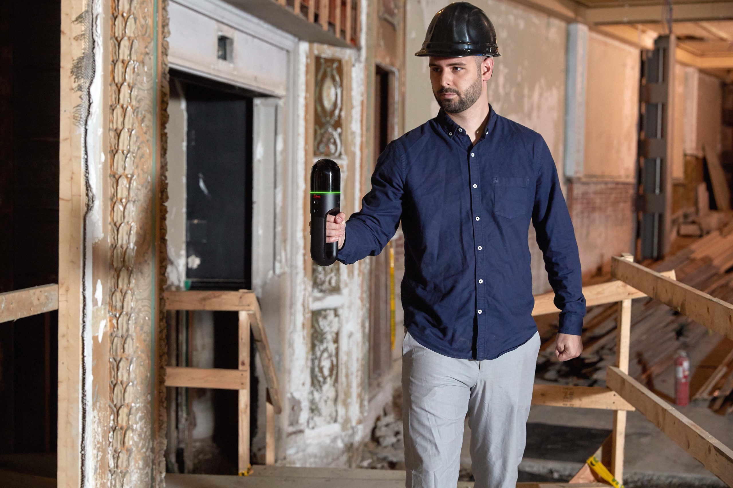
Recreate spaces in 3D as you move: Leica BLK2GO
Talk to us today to find out how you can accelerate your digital construction journey.